
Historic West Virginia flooding prompts statewide emergency as severe storms sweep East
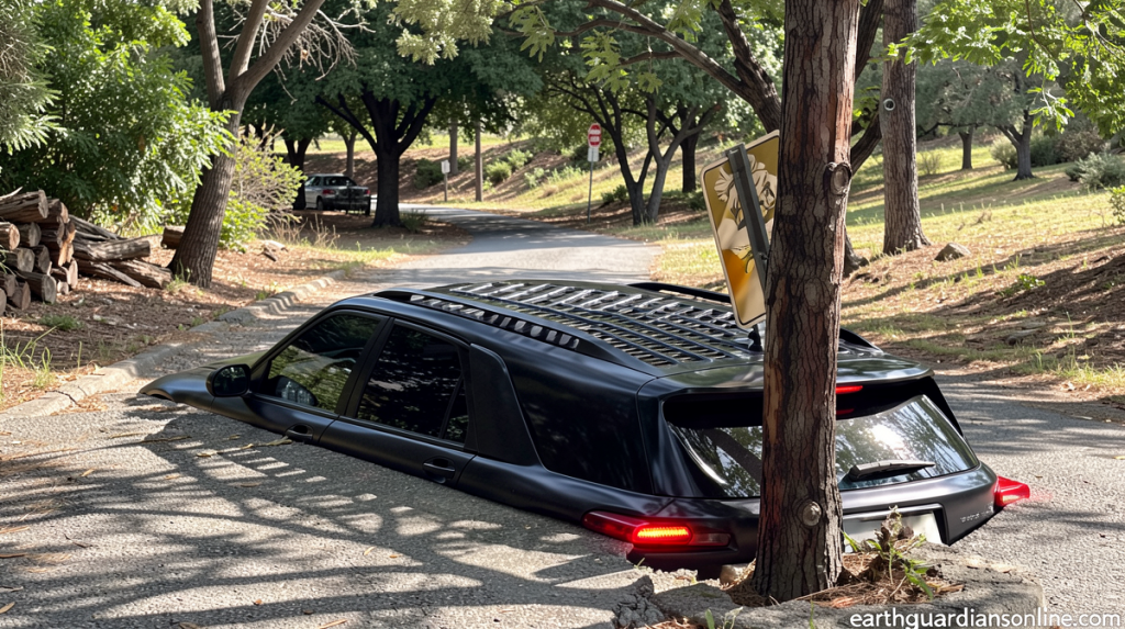
Severe Storms Spark Emergency Response in West Virginia
Earthguardiansonline.com – Historic West Virginia flooding prompts emergency declarations as a powerful weather system delivers devastating conditions across the eastern United States. West Virginia has borne the brunt of catastrophic flooding, with severe thunderstorms sweeping through the region on Tuesday. These storms brought torrential rainfall, spawned tornadoes, and generated damaging winds stretching from Kentucky to New Jersey.
Residents in parts of Upshur County experienced extraordinary precipitation levels, with more than five inches of rain falling within approximately six hours during Tuesday afternoon. This deluge prompted the National Weather Service to issue a flash flood emergency—the most severe classification available—designating it as a particularly dangerous situation. Water levels reached unprecedented heights throughout the region.
Breaking Records After Eight Decades
The Sand Run stream gauge located near Buckhannon recorded water levels surpassing 10.6 feet late Tuesday evening. This measurement dramatically exceeded the previous record of 8.3 feet established during the catastrophic 1985 flood event. Marking the first occasion in approximately eighty years of continuous monitoring that the gauge has achieved major flood stage status, the current situation represents a significant meteorological milestone.
The parallels to 1985 extend beyond water measurements. That historic flood claimed forty-seven lives in Upshur County alone while destroying thousands of residences and hundreds of commercial establishments. The devastation was so extensive that it reshaped communities for years afterward.
In response to the unfolding crisis, Governor Patrick Morrisey announced a state of emergency covering all fifty-five counties in West Virginia on Tuesday evening. This declaration enables state agencies to coordinate resources more effectively and deploy personnel and equipment wherever they are needed most urgently.
Emergency Response Mobilization
The West Virginia National Guard has mobilized approximately three hundred members who are expected to arrive in the hardest-hit areas by Wednesday morning. These personnel include swiftwater rescue teams, engineers, and various other resources designed to assist local emergency crews in their recovery efforts.
According to Governor Morrisey, the communities experiencing the most severe impacts include Lewis, Pleasants, and Upshur counties. In these regions, flooding and related damage have triggered ongoing emergency response operations, including dozens of water rescues conducted by first responders.
The West Virginia Emergency Management Division has established a shelter at Lewis County High School to accommodate residents who have been displaced from their homes by the rising waters.
Tornadoes and Widespread Damage
The same storm system responsible for West Virginia’s flooding also generated multiple tornadoes and widespread damaging winds across the Ohio Valley and into the Mid-Atlantic and Northeast regions. Tornadoes were confirmed in Kentucky, Ohio, and New Jersey on Tuesday, with one particularly notable occurrence in Clermont County, Ohio.
Denise Davis, a Clermont County resident, shared her experience with CNN affiliate WKRC. She described bringing her grandchildren to the basement immediately upon hearing the tornado warning. “The winds picked up, the lights were flickering and then I heard a real loud bang, which of course was the tree falling onto the house,” she recounted.
Davis added that everyone was in a safe position under the basement stairs when the tree fell. “I cried and then the grandbabies were crying,” Davis said, recounting the moment she first saw the tree on her house. “I just don’t know what to do from here.”
Two additional tornadoes were observed in northern New Jersey as supercell thunderstorms moved across that area. The widespread nature of the storm system has left approximately 110,000 people without electrical power across the affected regions as of Tuesday evening, according to Poweroutage.us data.
Extended Forecast and Tropical Influence
Flash flood warnings were issued for New York City on Tuesday afternoon but were subsequently lifted later in the evening. The city’s sewer infrastructure, constructed more than a century ago, is designed to handle only about 1.75 inches of rainfall per hour. In recent years, increasingly extreme weather events have exposed the limitations of this aging system.
When the system becomes overwhelmed by large volumes of rainfall occurring in short timeframes, the result includes flooded streets in low-lying areas, residential properties, and subway stations throughout the metropolitan area.
The frontal system causing disruption on Tuesday is expected to gradually move eastward through Wednesday, though residual moisture may continue to produce scattered showers across the region. Residents are advised to monitor local weather updates and avoid flooded roadways as conditions continue to evolve.
