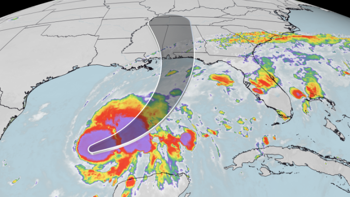
Hurricane Lowell makes final turn toward Hawaii as islands brace for impacts

Daftar Isi
Hurricane Lowell Pivots Northward, Putting Hawaii’s Western Islands on Direct Path
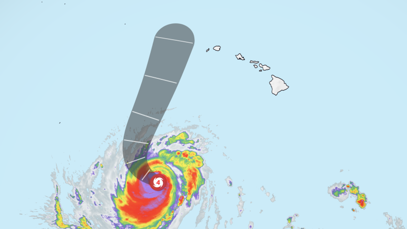
Earthguardiansonline.com – For days, a stubborn ridge of upper-level high pressure pinned a powerful hurricane to a westward track south of the Hawaiian chain, effectively shielding the islands from its worst effects. That shield dissolved over the weekend. A cold-air trough descending from the north Pacific collided with a nearby low-pressure zone, weakening the ridge and freeing the storm to execute a sharp right turn. The result: Hurricane Lowell is now swinging northward, aimed squarely at the western Hawaiian islands, and forecasters expect it to pass within striking distance of Kauai and Niihau from late Monday night through Tuesday morning local time.
The system, currently rated a Category 3 hurricane with sustained winds of 120 mph, is moving north at roughly 9 mph. It has oscillated between categories during its transit, a pattern meteorologists describe as the normal cycling behavior of a major hurricane. By the time it reaches closest approach, Lowell is projected to weaken to near Category 2 intensity. Its center is expected to track approximately 100 miles west of Niihau and 150 miles west of Kauai — close enough to deliver severe impacts, far enough to spare the islands a direct landfall.
Third Storm in Three Weeks: El Niño’s Pacific Amplifier
This is the third tropical system to target Hawaii in just over three weeks, a frequency made possible by El Niño conditions that are supercharging the Pacific hurricane season. Warmer sea-surface temperatures across the central and eastern Pacific have fueled an unusually active basin, pushing multiple storms toward island chains that typically see only one or two tropical events per year. For Hawaii, the cumulative fatigue of back-to-back storms compounds infrastructure strain, depletes emergency reserves, and heightens public anxiety even before a single system makes landfall.
Emergency Mobilization Across the State
Hawaii Governor Josh Green declared a state of emergency for the entire state, a designation that unlocks federal resources and authorizes activation of Hawaii National Guard units. Six high-water vehicles are being staged on Kauai to handle anticipated flooding on low-lying roads. Kauai County moved Sunday to close every park and campground on the island and to open five designated refuge areas for residents who may need shelter.
“Closing our parks and opening refuge areas is not a decision we make lightly, but it is the right call with a storm of this strength still turning toward us,” Mayor Derek S.K. Kawakami said in a statement.
The Kauai Emergency Management Agency issued advisories urging residents to remain indoors, avoid roads as conditions deteriorate, fill fuel tanks, charge electronic devices, and stock sufficient water and food. In Lihue — a town of roughly 8,000 that hosts Kauai’s primary airport — supermarket shelves were visibly thinning as residents stockpiled supplies ahead of the storm’s arrival.
“We’ll lose some power, probably have some trees, a bunch of tree limbs coming down,” real estate agent Lori Benkert said. “Everybody is probably going just to hunker down.”
What the Terrain Will Do to the Winds
Tropical-storm-force winds exceeding 39 mph are forecast to reach the western islands from late Monday into Tuesday. Because the storm’s center will remain offshore, the most intense winds will stay over open water. However, Hawaii’s steep volcanic topography acts as a wind amplifier: mountain peaks and upper slopes can experience gusts that reach hurricane force even when the storm’s core passes well offshore. Residents in elevated areas of Kauai and Niihau should expect brief but violent wind events.
Surf, Flooding, and Mudslide Threats
Long-period swells generated by Lowell are already producing hazardous surf across the state, and conditions are set to escalate sharply on Monday. A high surf warning remains in effect through early Tuesday for south-facing shores of Oahu, Maui County, and the Big Island. The National Weather Service in Honolulu projects that waves of 7 to 10 feet will build rapidly Monday afternoon and evening, reaching 12 to 20 feet along Oahu’s south coast and 12 to 16 feet across Maui County and the Big Island. Those waves carry the potential to overtop beaches, inundate low-lying coastal zones, and damage roads and other infrastructure. Powerful rip currents and large breaking waves at harbor entrances represent additional hazards for boaters and swimmers.
Rainfall will be the storm’s most widespread impact. Kauai and Niihau face 6 to 10 inches of rain, with isolated totals exceeding 14 inches possible in the most favorable storm tracks. The Big Island is expected to receive 4 to 8 inches, with isolated accumulations up to one foot. Oahu, Molokai, Lanai, and Maui will see lower totals of 2 to 4 inches, though mountainous terrain on those islands could locally produce up to 8 inches. The National Hurricane Center has issued warnings for significant flash flooding and mudslides, particularly in steep, recently saturated terrain.
As of Sunday afternoon, several roads on Oahu were already flooded, disrupting traffic flow, according to the Hawaii Department of Transportation. Those early inundations underscore how quickly even pre-storm rainfall can overwhelm urban drainage systems.
A Ghost of 1992
The current setup draws an unavoidable parallel to Hurricane Iniki of 1992, which struck Kauai as a Category 4 hurricane and remains the most destructive storm in Hawaiian recorded history. Iniki’s winds leveled structures, killed four people, and caused billions of dollars in damage. The resemblance is in the geometry — a powerful system turning northward to clip the western islands — but the critical difference is distance. Lowell is forecast to remain far enough offshore to avoid a direct hit, converting what could have been a catastrophic landfall into a severe but survivable wind-and-rain event.
Still, the cumulative toll of three storms in three weeks means Hawaii’s infrastructure, emergency services, and residents are operating under sustained stress. Each successive system degrades road surfaces, saturates soils, and exhausts response capacity, making the fourth or fifth event disproportionately dangerous. For now, the focus is on Lowell: stay indoors, stay off roads, and watch the western sky.
Related Reading
Frequently Asked Questions
What is Hurricane Lowell makes final turn toward?
Hurricane Lowell makes final turn toward is the main topic of this guide. The article explains the context, practical details, and next steps readers should understand.
Why does Hurricane Lowell makes final turn toward matter?
Hurricane Lowell makes final turn toward matters because readers are looking for a useful answer, not just a short summary. Good content should match search intent and help them decide what to do next.