Old myth that all roads lead to Rome debunked by new analysis

Daftar Isi
Roman Road Study Finds Empire’s Most Connected Routes Bypassed Rome
Earthguardiansonline.com – For centuries, the saying “all roads lead to Rome” has captured the imagined reach of the ancient Roman Empire. A detailed new study of its land routes, however, finds that Rome was not the key crossroads of the empire’s entire road network.
Researchers examining travel across Roman territory concluded that the network’s most central overland corridor ran elsewhere: along North Africa, through areas of present-day Turkey, past cities including Antioch and Ankara, through Constantinople, and then north of Rome toward Milan.
“When we look at all terrestrial transport in the entire Roman Empire, there’s one path that is the most central path going through the empire itself, and that path doesn’t go through Rome,” said Tom Brughmans, an associate professor in the School of Culture and Society at Denmark’s Aarhus University and a coauthor of the analysis.
The findings were published Tuesday in Nature Communications and draw on Itiner-e, a digital atlas released last year that maps the Roman Empire’s road system. The atlas brings together historical accounts, excavation material, satellite imagery and earlier datasets to chart roughly 186,000 miles, or nearly 300,000 kilometers, of roads.
A Mediterranean power with a different road center
At its largest extent in AD 117, the Roman Empire stretched from Britain to the margins of the Sahara. It covered parts of Europe, Asia and Africa across approximately 2.1 million square miles, or 5.5 million square kilometers. Rome was unquestionably the imperial center in political and economic terms, but its position did not make it the dominant hub for movement by road.
Its geography helps explain the distinction. Rome sat on the Italian peninsula, a location especially advantageous for travel and trade across the Mediterranean by sea. The peninsula was less ideally placed for the principal land connections that crossed the empire at continental scale.
“The Italian peninsula is just this land appendix sticking out into the Mediterranean,” Brughmans said, “so the most central path passed through the North African coast, then east through modern-day Turkey and cities like Antioch and Ankara, and then through Constantinople, before heading north of Rome, through Milan.”
Constantinople’s importance in the model is consistent with its strategic position. In 324, Emperor Constantine I transferred the imperial capital from Rome to Constantinople, formerly called Byzantium, for strategic and economic reasons. The city, now Istanbul, occupied a location linking routes across Europe and Asia and emerged as a major center within the road network.
The analysis does not diminish Rome’s historic prominence. Rome remained a seat of government and stood near major shipping lanes. Instead, it separates the empire’s symbolic and administrative center from the most connected route through its roads. In a vast territory bounded by different seas, mountain ranges and deserts, those forms of centrality did not always point to the same place.
Mapping an incomplete ancient network
The researchers assessed the road system using factors that included elevation, direction and slope. Their results also underline the limits of reconstructing infrastructure that is nearly two millennia old. Within Itiner-e, the precise location is established with certainty for only 2.7% of the roads. About 90% are mapped less precisely, while roughly 7% are hypothetical reconstructions.
That uncertainty is important when interpreting a map of Roman travel. The atlas represents the most extensive effort to assemble the available evidence, yet it also makes clear where knowledge remains tentative. Roads can vanish beneath modern cities, fields and later transport routes, while written references and archaeological traces may identify a connection without revealing every section of its exact course.
Even with those qualifications, the dataset allows scholars to test familiar ideas about Roman engineering and mobility at a much broader scale than individual surviving roads can provide. It also offers a more practical picture of how people, officials and information could move through a large and varied empire.
Straight roads were not a universal Roman rule
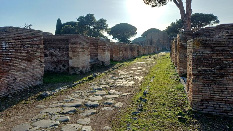
The study also challenges the widespread belief that Roman roads were consistently straight. Some surviving examples, including Rome’s Appian Way, have helped create that impression. Yet the wider road network was shaped by terrain and by the technical challenges of construction.
“If the topography allowed them to build straight roads, then they would build those straight roads,” Brughmans said. “But if the topography made it hard, then the roads would be wiggly.”
Where the landscape was favorable, Roman engineers could create notably direct routes. But hills, slopes and other obstacles meant that many roads had to follow more winding alignments. The study’s consideration of elevation and gradients helps show why a road’s route cannot be understood simply as a line between two settlements.
The researchers also found that modern transport routes do not always preserve Roman paths. Some current roads follow ancient alignments, but many roads described as Roman do not match the historic routes identified in the analysis. The legacy of Roman construction remains visible in places, though it should not be treated as a complete blueprint for today’s road map.
How a medieval saying outlasted the reality
The phrase “all roads lead to Rome” did not originate in the ancient Roman world. It dates to the medieval period and first appeared in writing in 1175, when French poet Alain de Lille used the Latin line “Mille viae ducunt homines per saecula Romam,” meaning “A thousand roads lead men forever to Rome.”
Ancient Romans nevertheless recognized the importance of their roads. In 20 BC, Emperor Augustus placed a “golden milestone” in the Roman Forum as a symbolic origin point for the empire’s major roads. That monument is often seen as one influence behind the later association of every road with Rome.
Today, the proverb is usually figurative, expressing the idea that different approaches can reach the same outcome. Its literal endurance is striking because the road-network analysis points elsewhere.
“It’s a medieval proverb, not an ancient one, and it indicates the symbolic centrality of this massive capital for this continental-scale empire,” Brughmans said. “Rome was on a nexus of major shipping lanes, and also where the government was, so it was definitely central. The unfortunate bit is the roads bit.”
“Perhaps what reinforced this myth is that there was a system of major roads that was used by the emperors to administer the regions and share information, like a communication network, and Rome was depicted as being at the center of that major road network. The persistence of this proverb is incredible, even though it’s demonstrably false.”
Related Reading
Frequently Asked Questions
What is Old myth that all roads lead?
Old myth that all roads lead is the main topic of this guide. The article explains the context, practical details, and next steps readers should understand.
Why does Old myth that all roads lead matter?
Old myth that all roads lead matters because readers are looking for a useful answer, not just a short summary. Good content should match search intent and help them decide what to do next.